
walks
Marsden Bay and Cleadon Hills
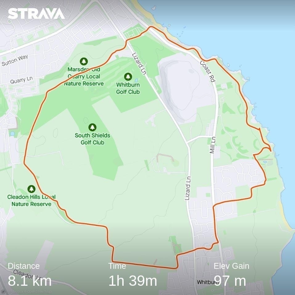
Another Saturday with no hockey. This time a result of snow still covering the pitch in Whitby rendering it unplayable. As I was up and dressed anyway, I decided to throw my walking boots in the car and head out to a nearer stretch of coastline for a walk and some fresh air. I chose a circular route I’ve done before from Whitburn, over the Cleadon Hills and back along the coast via Marsden Rocks and Souter lighthouse.
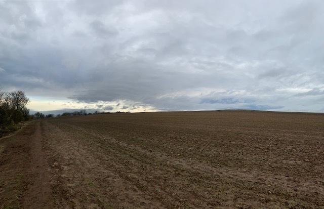
It’s on odd beginning through a housing estate, across a farmyard and then out into open fields. I was glad I’d done it before otherwise I would have thought I’d gone wrong somewhere.
The walk across farmland was very sticky and in places slippy - I almost went over a couple of times. The views across the fields were peaceful and I could forget that if I turned a little to the left the urban edges of Sunderland were visible in the distance.
As I came out onto the Cleadon Hills, there was a freezing wind and I was grateful that I’d finally picked up a Buff in the sales this week. Until the approach to Cleadon Windmill I’d barely seen anyone, but then I was reminded it was a Saturday morning, and the open common was filled with dog walkers.
The route was pretty busy from then onwards, across the golf course and back onto the coastal path where I met a large group of parents screaming at their kids (probably an under 10s football team) to keep away from the road. I chose to pause and let them get far enough ahead that I could return to my quiet thoughts.
There are some great stacks and arches that have been eroded from the cliff edge along this stretch of coastline. I paused frequently to watch the waves crash around them. I didn’t spot any smugglers though. The sea was probably a bit too rough.
Captain Cook Round
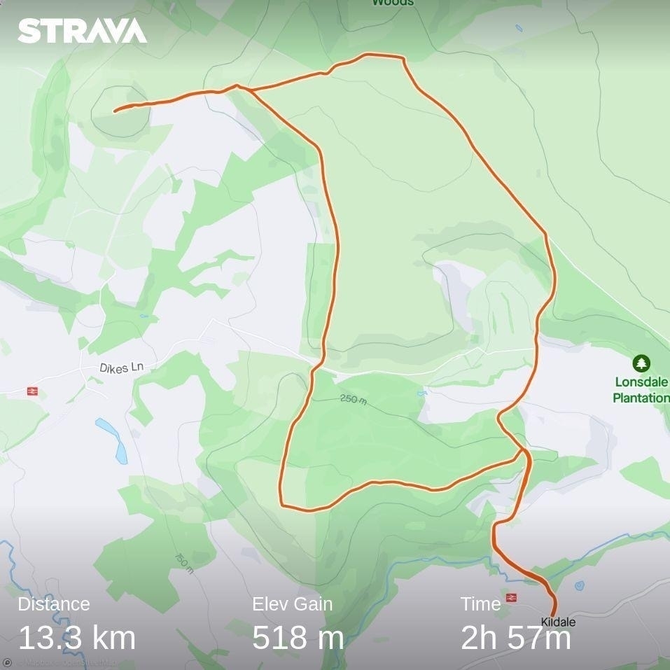
It’s rare we have a completely free weekend together but due to plans to visit friends falling through, that’s how we found ourselves this weekend. To get us out and about we decided to take ourselves on a long walk a little further afield than we’d usually go. We chose the Captain Cook Round from Pocket Mountains' North York Moors guidebook.
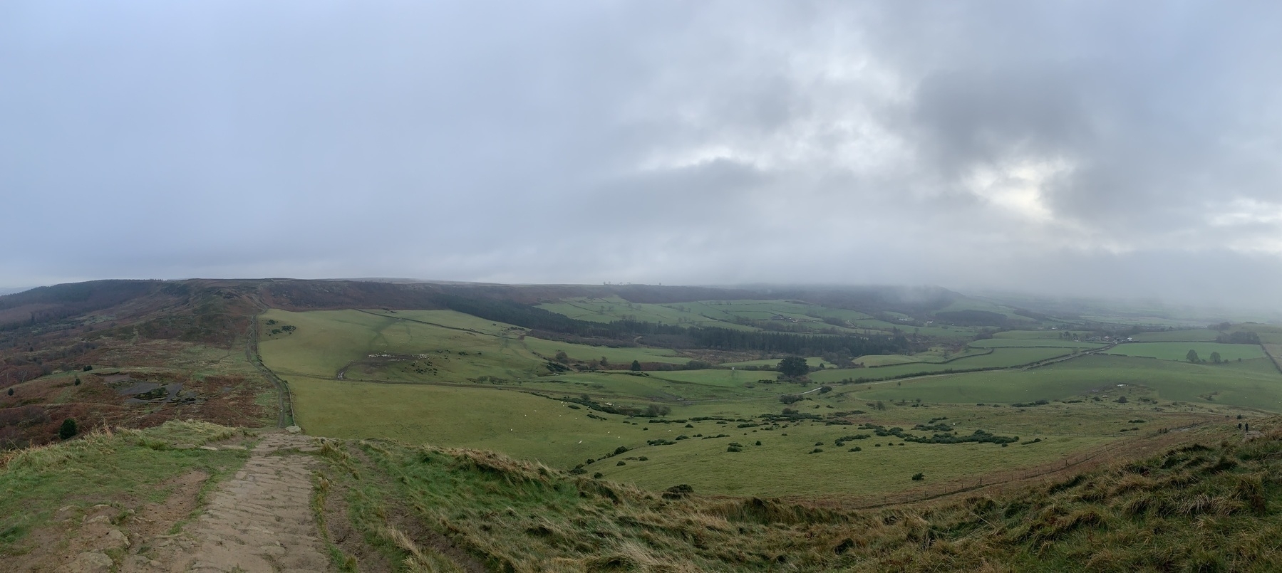
The day was overcast but still, fine while you were on the move but a damp cold set in if you stood still too long.
The walk started with a steep climb from our starting point at Kildale station up a lane to meet the Cleveland Way. Our route then took us across the moor where we saw a lot of grouse in the heather. We diverted off the main path to climb to the summit of Roseberry Topping which needed to be taken slow due to mud on the stone path.
Rejoining the Cleveland Way we dropped down to Gribdale, where we stopped briefly for our picnic. Then it was back on the ascent to Captain Cook’s monument which was shrouded in cloud when we got there.
As we decended through woods and farmland back to the station we caught sight of a barn owl in flight. It initially came alongside us from the farm buildings and into the woodland, then passed up the lane where we’d just come.
Distance: 13.3km Elevation: 518m Time: 2h 57m